© Wayne Watson

© Wayne Watson
© Wayne Watson
© Wayne Watson
© Wayne Watson
© Wayne Watson
© Wayne Watson
© Wayne Watson
© Wayne Watson
© Wayne Watson
© Radio TV Val d'Isere
© Radio TV Val d'Isere


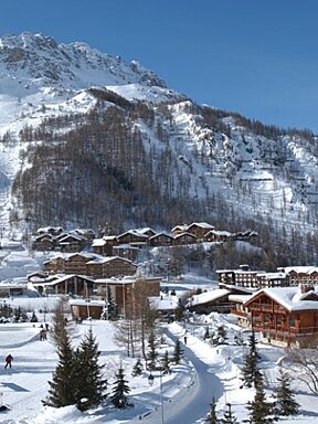
Soft pistes, Saharan sand & an avalanche in Val d'Isere
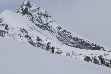
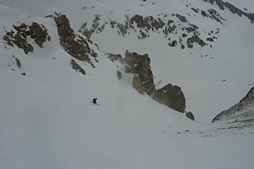
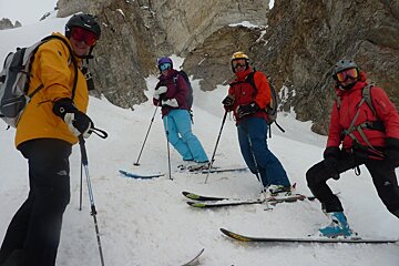
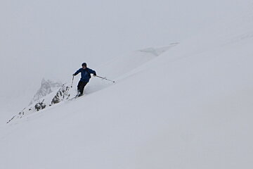
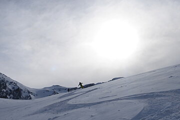
Well groomed spring snow on piste but tricky conditions off piste
It was a tough weekend on the weather front with extremely warm temperatures, grey skies and strong foehn winds. In fact the winds were so strong that the snow has a yellowish tinge to it because sand from the Sahara Desert has been transported by the southerly wind and deposited here.
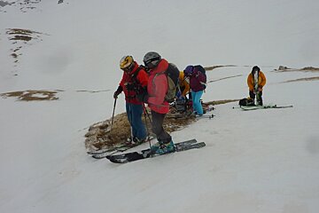
With the warm nights we’ve had little or no freeze which makes skiing spring snow very tricky as the support layer of snow is fragile, leaving us with very limited off-piste options. With that said we’ve had surprisingly good skiing but it hasn’t been easy.
The piste skiing has been much better, especially first thing as the pistes were well groomed and had a soft texture to them, much like perfect spring snow. Saturday is always the quietest day of the week and Sunday’s are the next best so piste skiing over the weekend is always good and with the spring-like snow conditions it was especially good over the past couple of days.
There have been a few flakes of snow floating about and we’re now at the stage of the season when any time we get fresh snow it’s imperative that people ski Northern slopes only and let the East, South and Westerly slopes have a chance of transforming to perfect spring snow. The northern exposures will have much colder snow and a better quality of powder while the spring slopes will have warmer, heavier snow that isn’t nearly the same quality and not as enjoyable to ski.
To have perfect spring snow the slopes must be ‘clean’ and smooth and if they’re skied in wet powder conditions the deep tracks refreeze at night leaving the slopes in question unskiable. If everyone skied north after a snowfall they’d have better powder skiing but they would also give the spring exposures a chance to transform into perfect spring snow, and therefore have much better spring skiing as well, and that’s a win-win situation for everyone.
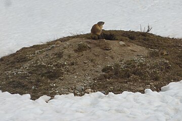
The first Marmottes of the season have been spotted so keep your eyes peeled. They can be seen off the walking path up at the Fornet towards the Pont St Charles and they can be spotted underneath the Palafour chairlift in Tignes. They are rather cute and are real crowd pleasers!
The weather this week looks slightly better as we should see a bit more sunshine but the temperatures will remain warmer than we’d like.
- Monday- Partially sunny am/rain and snow in the pm +1C/+9C Wind from the SE at 5km/h
- Tuesday- rain/snow +1C/+9C Wind from the SE at 5 gusting to 60km/h
- Wednesday-Partially sunny -1C/+8C Wind from the S at 5km/h
- Thursday-Partially sunny with rain and snow -1C/+5C Wind from the W at 5km/h
- Friday-Partially sunny with snow -4C/+1C Wind from the NW at 5km/h
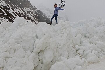
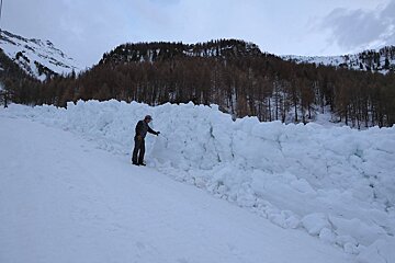
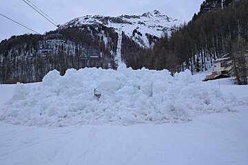
With the extremely warm temperatures and no refreeze at night to speak of the snowpack has become more unstable with each passing day. Last night around 6:45 a huge avalanche came down from the Super L and through the L piste and the juntion with the L and Mattis pistes. The avalanche travelled 1,000 meters and piled up 2.5 metres high. It travelled most of the way down a piste! (More photos here)
Had this avalanche come down during opening hours it could have had serious consequences. Pistes such as the L and the Santon are often closed during the afternoons due to a real avalanche risk so do respect the 'closed' signs on the pistes because they are closed for a reason!
Please excuse my photos as I have a dry weather camera and a wet weather camera that unfortunately has some water spots on the lens, which show up on the photos. The weather has been wet and humid all weekend so I've left my new camera at home and used the old one.
Have a fantastic week and look out for another update on Friday. If you want to follow the conditions on a daily basis log on to my blog on the link below.
-
For more updates on a daily basis, follow Wayne's blog.