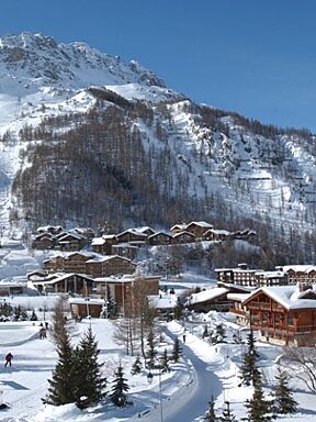
© Holly Millar
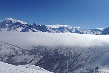
© Holly Millar

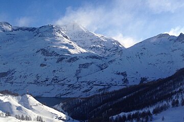
© Holly Millar


Val d'Isere Snow Report: 5th March 2015
Wild weather in Val d'Isere this week
Tignes has been hit with a real mix of weather this week! From bluebird powder days to extreme winds, to full on whiteouts, the first week of March has been a bit of a rollercoaster in terms of skiing conditions. Thankfully, along with this weather, we have received over 50cms of new snow this week.
Tuesday morning was one for the books for sure - sunny skies in the morning and superb snow conditions. If you stayed above 2100m there was lots of fresh and fast powder to be found across the Espace Killy. By the afternoon however, the sun caused many of the pistes to turn quite icy. The pisteurs spent the morning setting off avalanche bombs and quite a few avalanches could be spotted just beside the piste. For example, we saw a slide go just beside the top of the Aiguille Rouge at around 11h30. Be careful if you are heading anywhere off piste, especially steep slopes!
Unfortunately warmer temperatures have caused icy conditions in the lower parts of the resort - there were even reports of rain down in Brévières on Monday. What looked like powder was actually a thick crust of snow that was not very easy to ski through. Heading down to Boisses or Brévières is a great idea when there is a whiteout, just be aware of the changing snow conditions at lower altitudes.
This week we have had some really high winds here in the resort - definitely the most extreme of the season. On Monday most of the resort was closed due to the winds and poor visibility, but this made for great skiing on Tuesday as most of the fresh snow was still untouched. Luckily for us here in Tignes, whiteout days are usually followed by clear skies and sunshine. On Thursday, there were reports of winds gusting up to 100km/h at the top of Bellevarde in Val D'Isère and up to 50km/h in Tignes 2100m. At this point, most of the lifts are still closed to to hazardous high winds. If and when you make it out, remember that the wind chill factor will make temperatures feel much colder (around -19 degrees Celsius).
After Wednesday, the forecast is calling for sunshine until the weekend and well into next week. The sunshine will be great for working on your goggle tan, but the forecast is also calling for some seriously warm temperatures. Val d'Isere can expect to see temperatures go up to 7-10 degrees Celsius by the middle of next week. This means we can expect some spring conditions next week (which is always fun), but hopefully we won't lose too much of our snow base.
It snowed for most of Wednesday, leaving Tignes with over 10cm of new snow on Thursday. Good news about the fresh stuff and sunshine, but extremely high winds on Thursday morning will create wind blown conditions and turn the new snow to a hard crust - not the most ideal snow conditions. All this sunshine predicted for the next week means we will experience some melt-freeze conditions in the resort and will have spring conditions sooner than expected.
The avalanche hazard is currently set to 3 at considerable. Above 2500m there is an unstable slab due to strong winds over the past week and the risk of skier triggered slab avalanches is extremely high on steep slopes. Also, steep slopes that are exposed to the sun will be very unstable as they warm up - the more they heat up, the snow becomes heavier and far more unstable. If you are heading off piste use extra caution, as usual, and be aware of rapid warming.