© Holly Millar

© Holly Millar
© Holly Millar

© Holly Millar

© Holly Millar

© Holly Millar

© Holly Millar


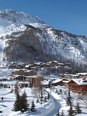
Val d'Isere Snow Report: 18th February 2015
Superb spring skiing and snow for the weekend!
Sunshine and bluebird skies are in the forecast for Tignes and Val D'Isère for the next couple days. More snow would be great, but the conditions in the Espace Killy are still great despite lower than average snow depths for this time of year.
Mid-February means we are over half way through the season, but with a bit of luck, we still might get a few more heavy snowfalls. Fingers crossed!
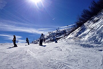
Over the last few days, mornings and nights have been a bit chilly at around -2 but things are warming up quite a bit by mid-day with temperatures at 2100m reaching 2-3 degrees Celsius. Perfect for enjoying a pint with lunch, but this is definitely making the snow on some of the lower pistes a bit slushy. You can expect some fun spring-like skiing conditions if you are heading out Tignes and Val D'Isère for the next couple days.
Freshly groomed runs with great snow conditions can be found each morning. The snow is hard, crunchy, nice and fast, then softening up as the sun hits it. On busier runs the loose snow is being pushed to the sides, leaving some very hard and almost icy areas in the middle of the piste.
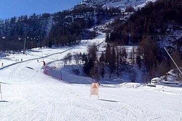
For the steeper runs like Trolls in Tignes and Face in Val D'Isère, stick to the side of the piste for the best conditions. Also, runs that are in the sun will have softer snow and might be a bit nicer in the morning. With all the crowds this week, the snow on those runs gets scraped off and they can become quite slippery and icy.
The warm and sunny temperatures will last until about Friday, so if you haven't had a good Après ski session this week, go soak up some on a patio sun after you hit the slopes. This weather we are having is definitely enjoyable, but it does mean we are still without fresh snow. Various forecasts are calling for some snow on Saturday, so let's all hope we can get a few powder days in next week.
Temperatures are forecasted to drop quite a bit Friday to a low of -9 degrees Celsius at 2100m and a few storm fronts coming through the Alps should bring us some actual snow. Still a bit early to tell, but it looks like a moderate snowfall is in store for Saturday and we can expect a more significant dump by Monday or Tuesday of next week.
Some weather sites are predicting up to 30cm of snow, but again it is still too early to tell. Despite conditions being great on the hill, the warm weather has certainly melted a lot of snow and we could REALLY use a fresh dump to keep our mountains healthy.
The avalanche risk has only just dropped back down to moderate at level 2. Please be careful if you are heading off piste and avoid steep north facing slopes. Conditions for the past few weeks have made it very unstable in the backcountry, so only venture off piste unless you are experienced and know what you are doing. There have been quite a few natural and human triggered slides across Val D'Isère over the past week so please ski and ride with caution and common sense. Checking the daily avalanche bulletin is always a good place to start.